TOPTON, NC
| RIDE TYPE Mixed Surface | DISTANCE 66.4 Miles | TERRAIN Mountains |
| GRAVEL 48% | COURSE Out & Back | ASCENT 5811 Feet |
| PAVEMENT 52% | SETTING Forest | HIGHEST POINT 3803 Feet |
Water defines the 66 mile mixed surface Rainbow Springs route in Western North Carolina. The route is an out & back along the banks of the Nantahala River and a significant portion of the route features crashing whitewater within river’s gorge. A spin along the lake and views of 5000 foot peaks will have you reaching for your camera. A fast finish will have you grinning like a little kid.
The Nantahala River runs 48 miles from its source near the Southern Nantahala Wilderness to its confluence with the Little Tennessee River at Lake Fontana. The final eight mile section is incredibly beautiful and wildly popular with anglers and kayakers but highway 74 adjacent to the river serves commercial rafting buses, auto tourists and a significant amount of truck traffic. The Rainbow Springs route avoids the traffic by starting at the Beechertown kayak launch and heading in the the opposite direction, following the river towards its headwaters at Whiteoak Bottom in the shadow of 5500 foot high Standing Indian Mountain.
The route warms up on a short section of trail where you can admire $300 carbon fiber paddles and river-rafters in polka dot swimsuits starting their journey.


The course then hits the road proper, heading upstream through the narrow gorge and remaining as close to the Nantahala as possible. Long stretches of road are right along the water’s edge and where the river can’t be seen it can often be heard. A 1.5 mile meander along the shore of Nantahala Lake serves as a quiet counterpoint before climbing 1100 feet above the lake on the road from which the route takes its name.
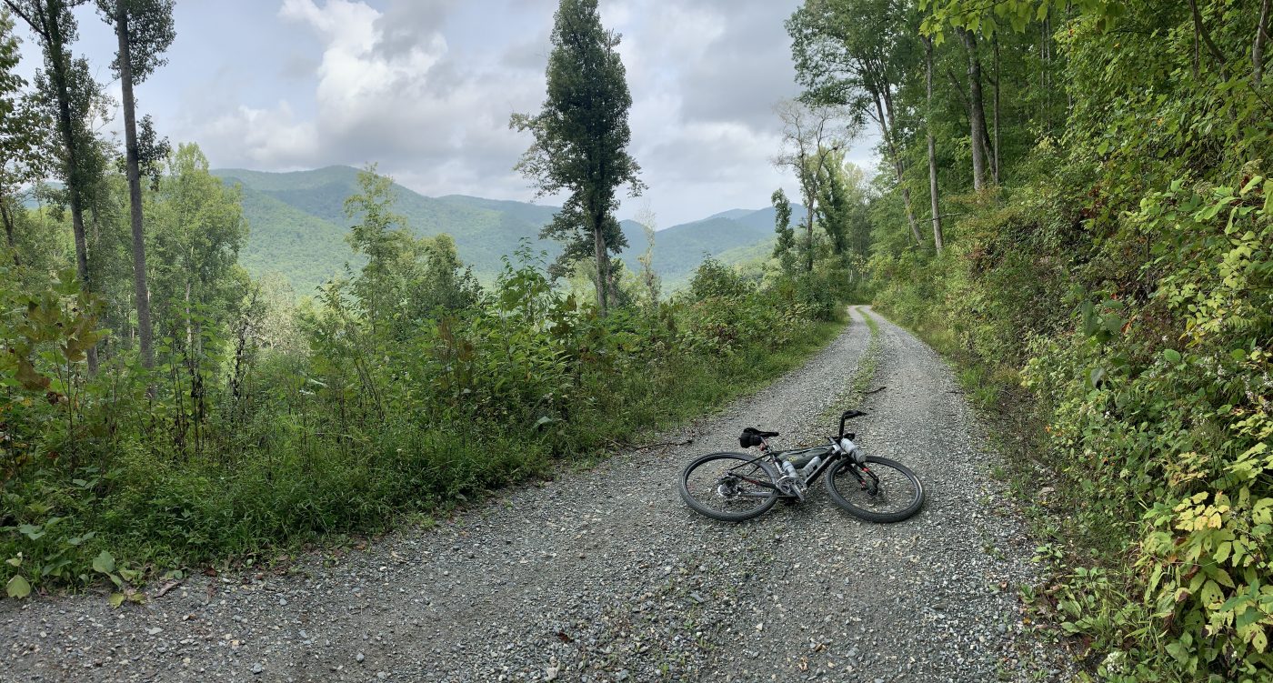
Rainbow Springs Road is almost 13 miles long and has amazing views of peaks on the other side of the valley. Keep your eye open for brief views of the lake far below. Local residents tell of a stand of Eastern Hemlocks somewhere near the top and “A good distance off the road,” notable for the fact that they even exist, not yet having fallen prey to the invasive Woolly Adelgid like so many others. This long stretch of super-primo gravel provides ample opportunity for solo riders to loose themselves in thought (or existential self-reflection), interrupted only by an an occasional waterfall or group of riders on KTM’s and Kawasaki’s. Bonus points for racing the motorbikes down the switchbacks!


Gurgling feeder creeks keep company as pavement resumes and the route diverges from the river. There’s a final climb to the route’s highest point followed by a fun descent into Standing Indian Campground. Its here that the route reverses and heads back to the start.
The camp store sells only the most basic supplies – small bottles of water, candy bars and chips. Drinking water and restrooms are also available at the day use area. Keep in mind that the campground and camp store are open seasonally so self-sufficiency will be a requirement during the colder months. Check the logistics tabs below for campground contact information and links.

63% of the elevation gain on the Rainbow Springs route is on the outbound leg and your average speed should be somewhat higher on the way back. The final ten miles can be ridden like a stage win but only if you throw your hands in the air at the end. Seriously… The paved descent down Junaluska Rd, flat and fast Beechertown gravel and the final paved sector descending through the gorge might be the most fun you have all year. Don’t worry about missing the scenery – just come back and ride the route again.
Check the comments section below for community updates and tell everyone about your experience if you ride the Rainbow Springs route.


- Wayah Rd is popular with sport-touring motorcyclists and you may encounter dual-sport riders on gravel. Its fun to watch them carving turns on pavement or over-cooking the gravel switchbacks but be aware of their presence on the road nonetheless. A daybright rear blinky is recommended.
- Also be aware of camper-trailer traffic approaching Standing Indian Campground. Take the lane to protect yourself if the occasion arises.
- Keep in mind the narrow gorge. Check the weather before heading out and heed flash flood warnings.
- Burly mountain bikes might be overkill on this route. Cross bikes and sporty gravel bikes are the sweet spot.
- Posted elevation data is based on the selected Ride with GPS basemap, typically OSM Outdoors. Your actual elevation may vary slightly.
- The start location at the Beechertown public kayak launch can get busy in summer but local kayakers report that it rarely gets overwhelmed to the point of running out of parking spaces. There are several turnouts along Highway 74 which will suffice in a pinch.
- Restrooms at the kayak launch were extremely clean when the route was scouted on 9/19/20. There are also several changing rooms but these were locked.
- The Standing Indian campground store is open seasonally and even then, it has a very limited selection. The day use area has water and toilets. Self sufficiency will be required during the off season when the campground is closed. The camp store's phone number is (828) 369-0442. See https://www.recreation.gov/camping/campgrounds/234228 for campground information.
- The only other possible resupply point on the route is the Land's End Cafe & Grill (boater guzzling bar) at mile 13/58.
Terms of Use: Use of this route is at your own risk. This route map and associated route descriptions are believed correct at the time of publication but accuracy cannot be guaranteed. You assume all responsibility for 1) checking weather and road conditions, 2) knowing and obeying land use rules and restrictions, 3) knowing and obeying all rules of the road, 4) carrying and using proper safety and navigation equipment and, 5) knowing the limits of your physical ability. SoutheasCyclingRoutes.com, contributors and Timothy Hollingworth are in no way liable for personal injury, damage to personal property, or any other loss to individuals following this route or using information contained in the route map or description.
Leave a Reply