
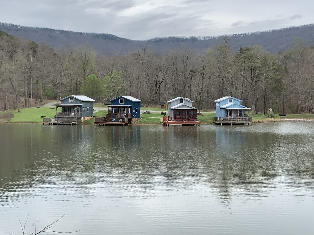
RISING FAWN, GA
| RIDE TYPE Mixed Surface | DISTANCE 46.6 Miles | ASCENT 3225 Feet |
| COURSE Loop | TERRAIN Rolling, Mountains | SETTING Rural, Forest |
The 46 mile Cloudland route consists of three long horizontal paved sectors interrupted by two short vertical gravel sectors. The first gravel sector descends the west side of Lookout Mountain to the hamlet of Rising Fawn, GA and another ascends back to the crest. Stunning views, the gorge and waterfalls at Cloudland Canyon State Park and the ride along the escarpment make this an unforgettable route.
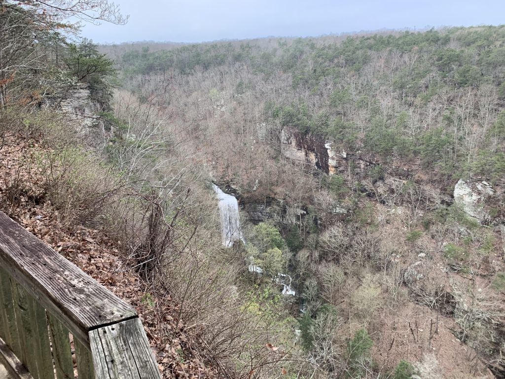
The Cloudland route starts at Cloudland Canyon State Park at the top of Lookout Mountain in extreme northwest Georgia. The park features towering waterfalls spilling into the canyon and is worth visiting even apart from cycling. Restrooms and water are available at the starting point.


The route escapes the park and avoids the main entrance on a short section of gated doubletrack before beginning the first paved sector. Expect woodlands, meadows and a few sizeable rollers before plunging off the western edge of Lookout Mountain on gravel. Sulphur Springs Gap Rd is steep and will affirm your choice to pay extra for bigger rotors (or make you wish you had).


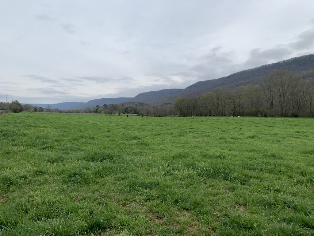
A paved, eleven mile spin through the valley has almost constant views of the mountains and passes through the hamlet of Rising Fawn before a store stop at mile 26.2. In many ways this is an area which time has forgotten. Barney Fife and Sheriff Andy would fit right in.
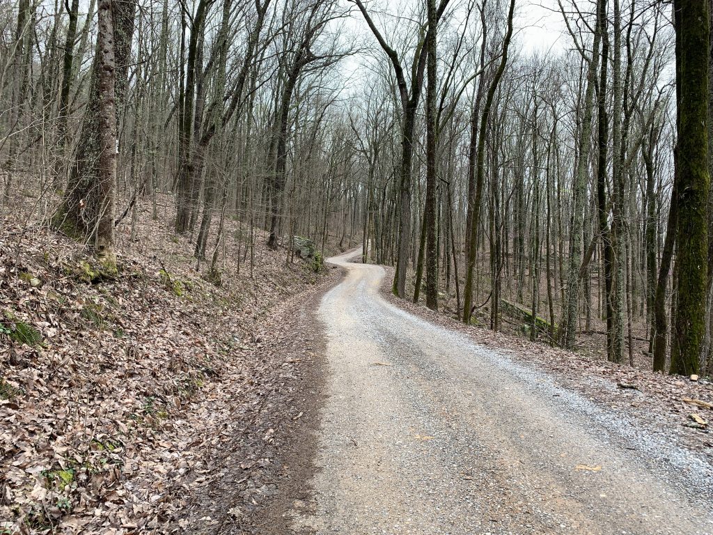
Newsome Gap Rd isn’t nearly as steep as the previous descent and the manageable grade makes for a fun gravel climb back to the brow of Lookout Mountain. The area is riddled with caves and one located just a few feet off the road. Look for the rock with faded graffiti at mile 31.5. The narrow cave entrance sits just above.


The final paved sector is fast and fun with spectacular views from the escarpment. Along the way you ride on Plum Nelly Rd and pass the the Plum Nelly Farm.
It began in 1947 at an outdoor art show held at Fannie Mennen’s house on the back of Lookout Mountain, Georgia. Ms. Mennen’s property had years earlier been named Plum Nelly when her brother-in-law, Louis Marks, after driving, what to him seemed a long way from Chattanooga, remarked, “Fannie, your place is plum out of Tennessee and nearly out of Georgia.” (Louis’s Virginia Tidewater accent was responsible for the change from nearly to nelly.)
Read more…
The route eventually reenters Cloudland Canyon State Park where a gate prevents motorists from entering without paying. Its easy enough to ride around but not before peering off the edge of the precipice. The final three miles of the Cloudland route are completed inside the park.


A fast CX bike would be perfect for this route but ride it with whatever you have. There is a short section of crumbling pavement approaching Newsome Gap Rd but the rest is smooth and gravel sectors were high quality as of publication date. Bring some food and plan to hang around at the park after the ride. Combining the Cloudland route with camping and hiking at the state park, exploration of the areas many caves or perhaps a visit to Rocktown, and historical attractions in the city of Chattanooga would make for an outstanding weekend getaway.


- Sulphur Springs Rd is steep.
- There can be a significant temperature difference between the valley and mountain top.
- This is truly the land of clouds. What appears to be cloud cover as you approach from the lowlands can be dense fog at the top of Lookout Mountain. Consider a blinky light just in case.
- Restrooms and water are available at the ride start indicated on the map.
- Cloudland Canyon State Park opens at 7:00 AM and closes at 10:00 PM. Gates are supposedly locked and signs threaten towing if cars are left after closing.
- There is a $5 parking fee. It is worth it.
- The state park can be very busy at times so plan to get there early during peak season.
- The nearest towns with services are Trenton GA to the northwest and Lafayett GA to the east. The City of Chattanooga TN is about 20 miles to the north.
Terms of Use: Use of this route is at your own risk. This route map and associated route descriptions are believed correct at the time of publication but accuracy cannot be guaranteed. You assume all responsibility for 1) checking weather and road conditions, 2) knowing and obeying land use rules and restrictions, 3) knowing and obeying all rules of the road, 4) carrying and using proper safety and navigation equipment and, 5) knowing the limits of your physical ability. SoutheasCyclingRoutes.com, contributors and Timothy Hollingworth are in no way liable for personal injury, damage to personal property, or any other loss to individuals following this route or using information contained in the route map or description.
This ride is a trip worth making. As for equipment, a gravel bike or even a hard tail trail bike are required. The Sulphur Springs Gap descent is -10% for 2 miles with numerous turns and it is rough gravel. My rigid gravel bike was a rough ride down. The Newsome Gap climb out is almost 4 miles and most of it is also gravel. RideWithGPS does not show that. I had one chaser dog who made a fairly good run of it before 136. The routes 136 and 157 segments on the way out are a little busy but make for a good loop. Once you turn onto Old State Road the trip is idyllic.
Rode this route for the first time yesterday and is certainly worth the drive from metro Atlanta. Tim is 100% correct: plan to spend the rest of your day at Cloudland Canyon SP — it is a gem! Also budget your time to stop many times along the ride for photo ops; the scenery is spectacular. As is always the case, be ready for a few stretches of canine motivation. We experienced a dog in exceptional cardio health early in the ride along Memorial Drive — he hung on our wheels for well over 100 yards as we touched 30 mph. Pepper spray is highly recommended as this dog clearly had ill intent.
As always, Tim’s write-ups are spot on.
Hi Tom. I don’t know of any groups. You might try posting to the Georgia Gravel Cyclists or Gravel Adventur Grind facebook groups. I’d offer to go but my gravel bike needs some new spokes on the rear wheel.
-Tim-
going tomorrow!
Looking forward to hearing how it went, Cale!
Tim – You sold me. This one is definitely on my “to do” list.
Hi Tom. I’m looking forward to hearing about your experience!