HEFLIN, ALABAMA
| RIDE TYPE Gravel | DISTANCE 46.0 miles | ASCENT 4050 feet |
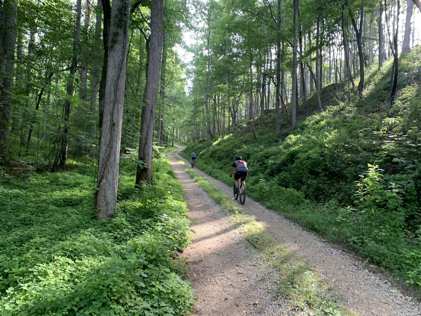
| COURSE Loop | TERRAIN Rolling | SETTING Forest |
The Shake n Brake route offers 46 miles and 4050 feet of punchy climbs and primo gravel located only 1.5 hours west of the Atlanta suburbs in the Talladega National Forest near Heflin, Alabama.
The Alabama Shake n Brake route is geographically compact, crossing over itself several times. One is never more than ten miles by bike from the starting point.
Your view of this route depends on your perspective. Riders from Florida might be uncomfortable with the constant up and down while riders from the mountains may find welcome relief in the shorter climbs. Either way, the first six miles consists of series of unrelenting kickers before hitting a two mile paved sector on Rabbittown Road at the north end of the route. The longest climb of the route begins shortly after turning back into the forest, after which the punchers and kickers continue. A series of long rollers signals the approach to the end of the route but it never really flattens out. A fast 2.5 mile hardpack descent leading to the final paved sector is one of the highlights of the route.
The Talladega National Forest enjoys frequent prescribed burns and much of the route lacks the dense undergrowth found further north in the mountains. The forest has a different character, more open and less claustrophobic. There are several meadows toward the end of the route and even a small field of sunflowers. Be sure to soft-pedal through beautiful Pine Glen campground at mile 21.
The Shake n Brake route has less than five miles of pavement. Road quality is generally good but there are short sections of babyheads and washout requiring careful line selection. The forest service may dump large amounts of gravel in advance of hunting season, especially in flood prone areas such as creek crossings so be aware if you ride in the late fall or winter. Otherwise, this route is well suited to fast gravel bikes and powerful riders able to muscle over the many short, punchy climbs.
- The Taladega National Forest is popular with hunters. Riding during hunting season is not a problem if you stick to established roadways. Just be aware of extra traffic during deer season and use common sense.
- The route start has no cell service so plan a meeting place ahead of time if you plan to ride with a group. The entrance to the Warden Station Horse Camp is a convenient gathering spot.
- Park at the Warden Station Horse Camp or the hunting check station across the road.
- County Road 61 is paved from Highway 78 almost all the way to horse camp.
- Vault toilets are available at the Pine Glen campground located at mile 21 on the route map.
- Water will be an issue, especially in the heat of summer. You will pass your vehicle at mile 16 but there are no water sources apart from creeks for the remainder of the route. Consider extra bottles or a hydration pack.
- The nearest towns with services are Heflin, located approximately 15 miles south of the start locatoin or Anniston, located approximately 20 miles to the southwest.
Terms of Use: Use of this route is at your own risk. This route map and associated route descriptions are believed correct at the time of publication but accuracy cannot be guaranteed. You assume all responsibility for 1) checking weather and road conditions, 2) knowing and obeying land use rules and restrictions, 3) knowing and obeying all rules of the road, 4) carrying and using proper safety and navigation equipment and, 5) knowing the limits of your physical ability. SoutheasCyclingRoutes.com, contributors and Timothy Hollingworth are in no way liable for personal injury, damage to personal property, or any other loss to individuals following this route or using information contained in the route map or description.
This is a great ride and not to be missed. My Garmin showed 5,200 feet but there are no long climbs. There were many deer hunters out November 6 and not many bikes.