EATONTON, GEORGIA
| RIDE TYPE Mixed-Surface | DISTANCE 60.5 Miles | ASCENT 2532 Feet |
| COURSE Loop | TERRAIN Rolling | SETTING Forest |
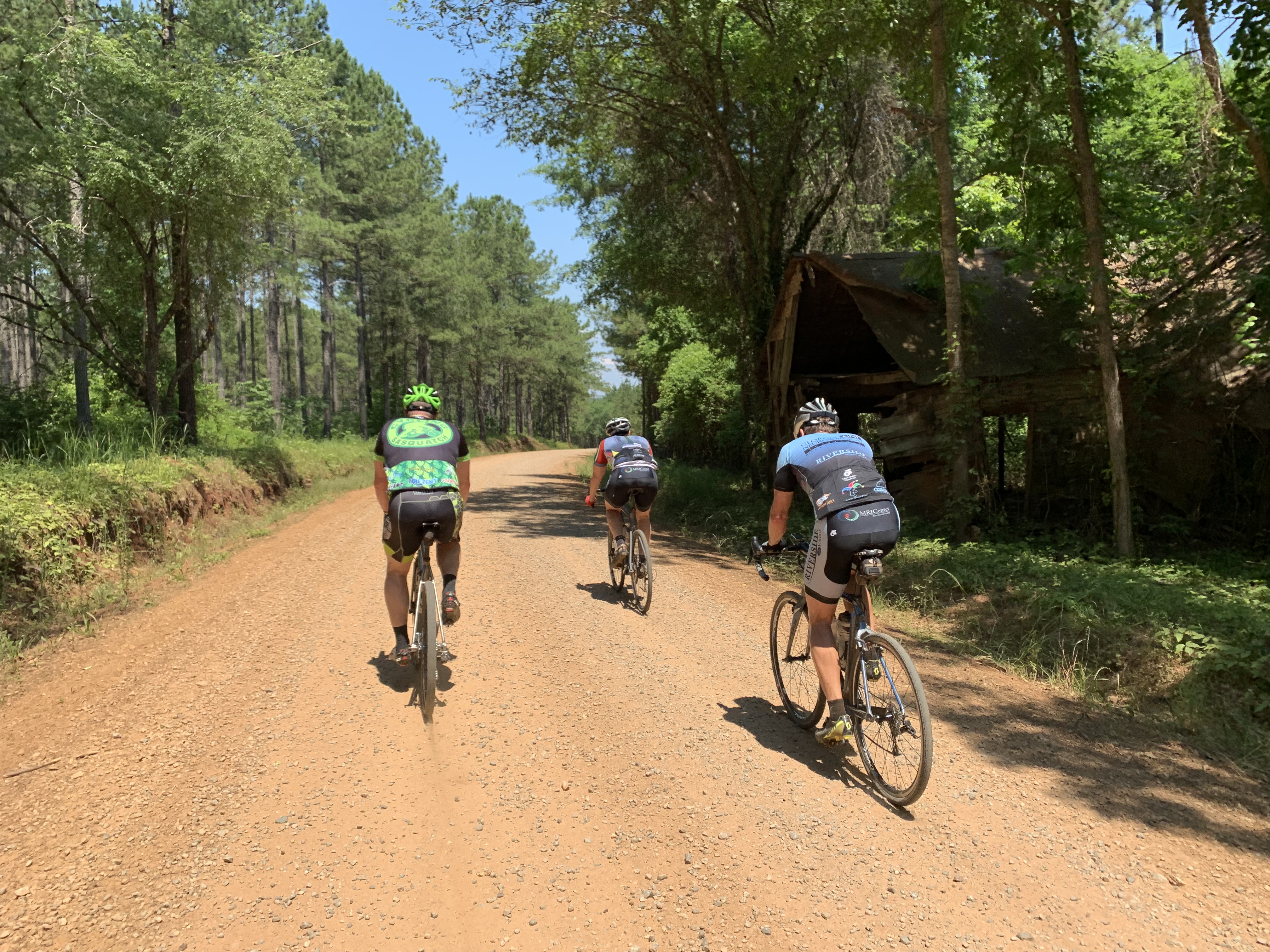
The Red Clay Ramble is a gently rolling, 60 mile mixed-surface route through the farms and forests of Middle Georgia. Yes, the soil is red clay. A store stop in the town of Gray has been added to the “official” race route for the sake of hydration.
The Red Clay Ramble route was developed by Benny “BluesDawg” Watson for use as an organized event. In recent years it has become the setting for the well attended gravel race which bears the route’s name. Whether raced for glory or ridden for pleasure, Red Clay Ramble is an apt name.
This route starts in the middle of nowhere in the middle of Georgia. The dot on the map closest to the start location says Eatonton but the Monticello dot is almost as close. If you can find the Cedar Creek Wildlife Management Area sign on Checking Station Rd then you are there.
This is the Georgia Ray Charles had in mind when he sang about moonlight through the pines. This is the home Otis Redding left to go Sittin’ on the Dock of the Bay. In fact, you will ride on Otis Redding Rd but the road itself doesn’t seem to do the man justice.
Expect gently undulating terrain through national forest land, alfalfa fields, pine forests and pecan groves. Climbs never seem to last more than a minute or two. About 15 miles of this route is paved and the only traffic you are likely to encounter will be on the 2.5 mile stretch of Eatonton Highway getting to and from the town of Gray which has the route’s only store. The stop is at mile 30, exactly half way through the route, and you are going to need it in the heat of summer.
Take a moment to look at the old buildings and memorial to past residents in the small town of Round Oak (mile 43) if you have the time. Local riders sometimes start the route here and its a great place to relax under a tree for a few minutes.
The Red Clay Ramble route can easily be shortened by using any number of local roads seen on the map.
- The correct line is the middle of the bridge, not the planks toward the outside.
- A little bit of rain will help keep the dust down but significant downpour will turn the red clay into peanut butter.
- Park at the wildlife management area check station on Checking Station Rd. There’s plenty of room.
- Bring a trowel and your own toilet paper in case you have to go.
- Apart from the store stop in the town of Gray, zero services means zero service. Consider a third bottle or hydration pack in the heat of summer. It can be blisteringly hot here.
Terms of Use: Use of this route is at your own risk. This route map and associated route descriptions are believed correct at the time of publication but accuracy cannot be guaranteed. You assume all responsibility for 1) checking weather and road conditions, 2) knowing and obeying land use rules and restrictions, 3) knowing and obeying all rules of the road, 4) carrying and using proper safety and navigation equipment and, 5) knowing the limits of your physical ability. SoutheasCyclingRoutes.com, contributors and Timothy Hollingworth are in no way liable for personal injury, damage to personal property, or any other loss to individuals following this route or using information contained in the route map or description.
Otis Redding Dr has been paved.
This was a really fun route, I particularly enjoyed the rolling nature of the terrain. I hit the Eatonton Highway at about 11:30 on a Saturday morning and decided potentially dying of dehydration or starvation was a better option than taking the road to the store stop and becoming road kill, based on heavy and fast tractor trailer traffic. For those looking for a slightly shorter version (about 35 miles), the organizers of the well attended gravel race mentioned above have posted it online, just search Red Clay Ramble Short Route. You want the one that starts at the Check Station.
I was thinking of going down there next week….
For this route, I had 60.89 miles and 3,522 feet climbed (Wahoo) – 60.31 miles and 3,711 feet climbed (Strava)
Great dirt roads for riding. Benny did a fantastic job with the inaugural RCR ride/race in 2013 and it’s only gotten better over the years. And as far as Otis goes “Try a Little Tenderness”…
Agree 100% James!
Water spigot at a church near Round Oak, unverified intel I picked up somewhere. Just across RR tracks at Round Oak.