
THE MOUNTAINS OF NORTH GEORGIA & SOUTHEAST TENNESSEE
| RIDE TYPE Bikepacking | DISTANCE 196.6 Miles | ASCENT 20,184 Feet |
| COURSE Loop | TERRAIN Mountains | SETTING Rural, Forest |
The word Appalachia invokes many images, some with a basis in reality and others conjured by Hollywood. The 197 mile Appalachia Bikepacking route confirms some stereotypes but dispels many more and provides a four to five day immersion into the rugged landscape and unique culture at the intersection of north Georgia, southeast Tennessee and extreme western North Carolina.
“In the five days I spent here, I didn’t meet one person who wasn’t friendly and welcoming” said one rider. In terms of people, this is the takeaway. Questions such as “How many gears that thing got?” and “How far ya ride each day?” are as likely as advice about where to camp. If you need water then flag down a horse drawn buggy or hybrid Jeep and just ask.


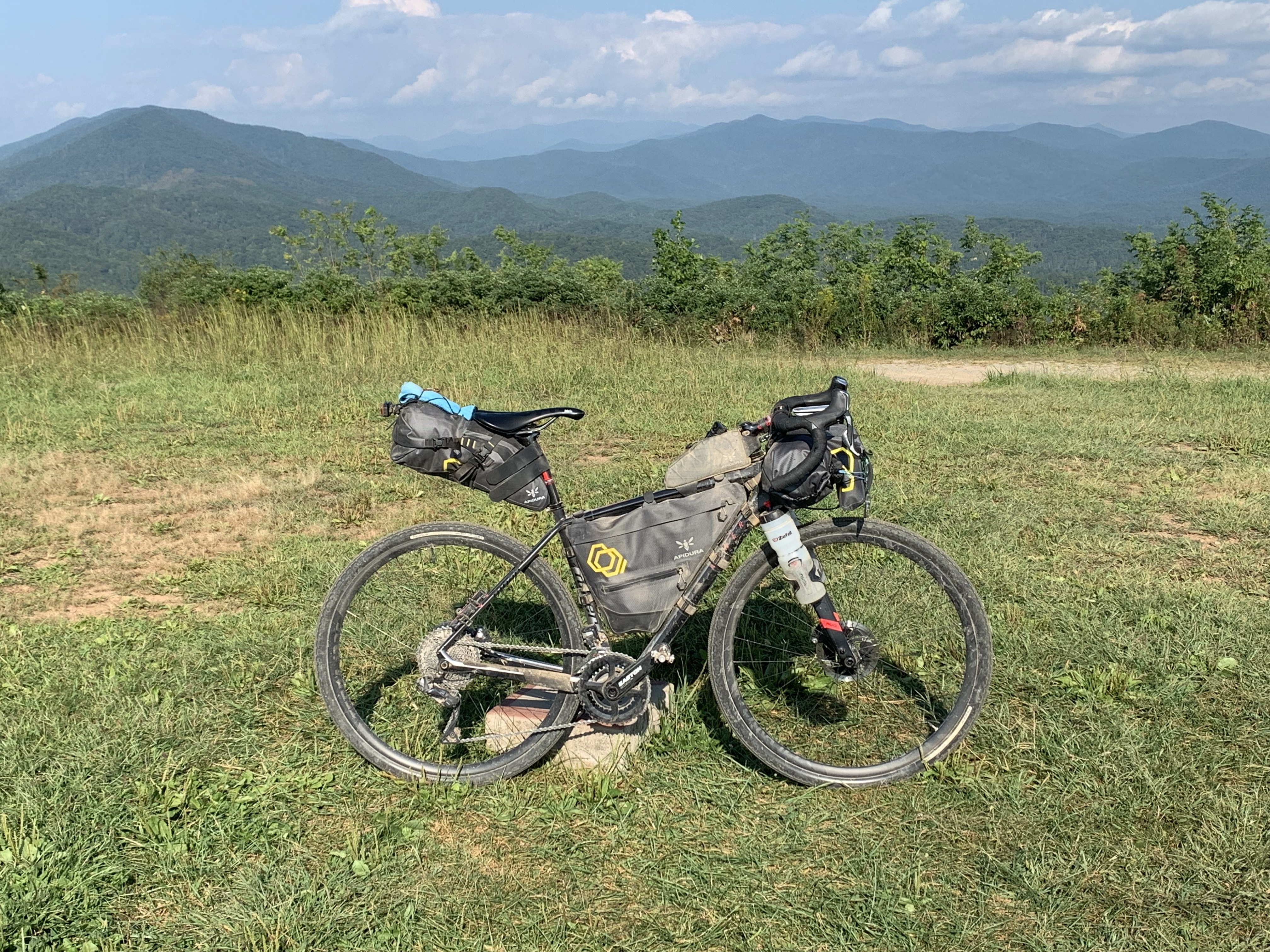
The area is rugged. Roads don’t always take the most logical or easiest route from point A to point B. The Appalachia Bikepacking route doesn’t either and includes the Gee Creek Horse Trail and section 14b of the Benton MacKaye hiking trail. The Benton MacKaye trail is open to bicycles and the relatively gentle grade along the ridge is actually the least difficult and more scenic way to approach the summit of Buck Bald. The Gee Creek horse trail ascends the Chestnut/Black Mountain massif and exists to crush your spirit before leveling out onto a ledge with vistas to the east. The descent off the massif toward the town of Tellico Plains is classic mountain switchbacks with rock walls and sheer cliffs.


Mile 83 to 118 form an arc from the town of Tellico Plains, east on pavement through the Tellico River Gorge and then west over the mountains on gravel roads bordering the Bald River Creek Wilderness. This section would make for an outstanding day ride in its own right. There are many campgrounds along River Rd and each one will make you wish you had pedaled a little further the night before.
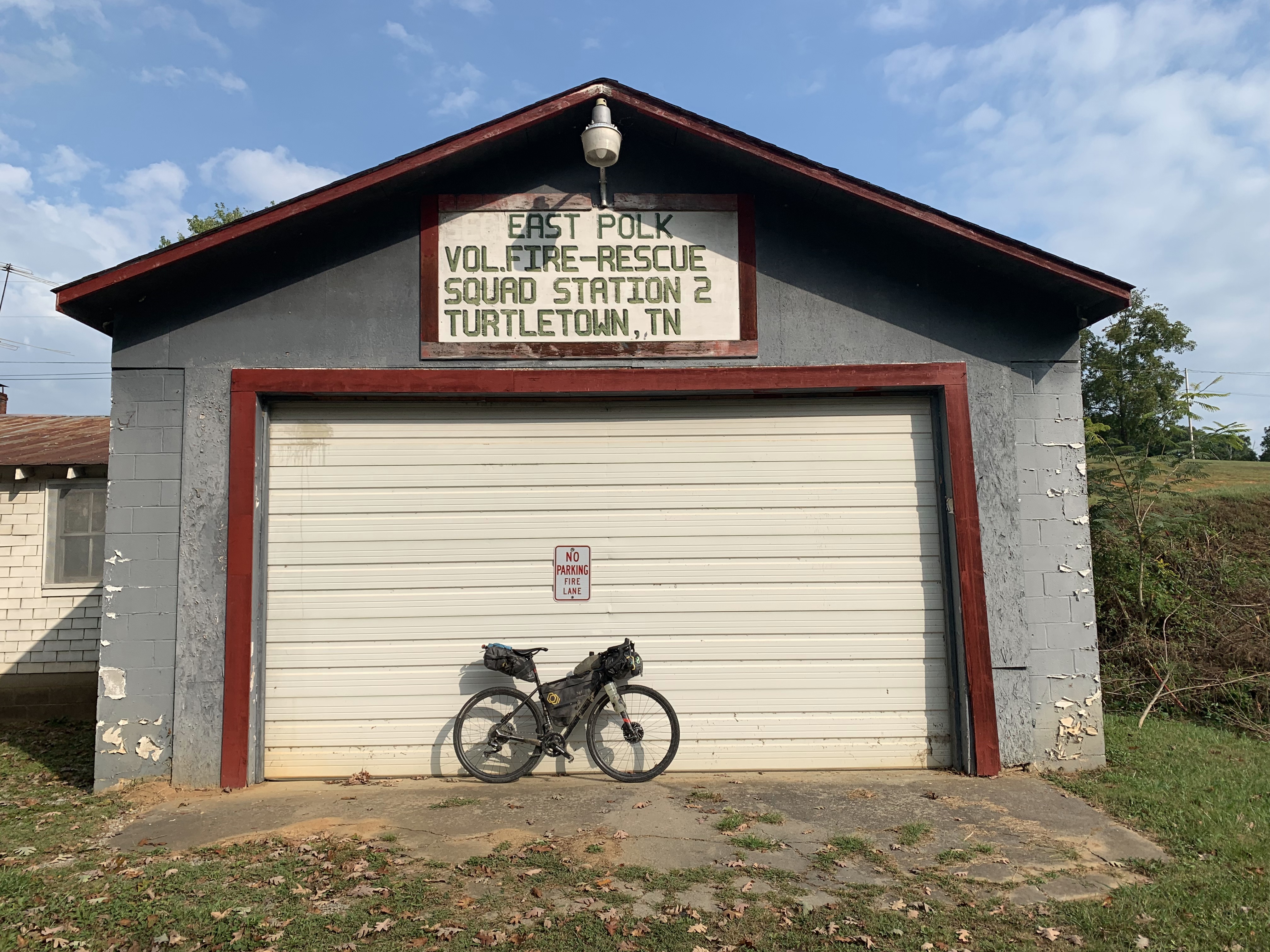
A 17 mile section of pavement returning south from Tennesse’s Hiawasse River offers opportunities for cheeseburgers, ice cream and an overnight at the Company House Bed & Breakfast. Towns with names such as Turtletown and Ducktown offer glimpses into the heart of the poor south before entering the singletrack trails along the Ocoee River. It is possible to avoid the singletrack trails and simply coast down into the Ocoee River Gorge. Either way is sublime.


The final 35 miles includes part of the Death March route around the Cohutta Wilderness where self sufficiency and a love of climbing are requirements.
Deciding on how many days to allocate for the route will likely come down to your level of fitness and how you prefer to camp. Those who prefer wild camping will have more flexibility. 20,000 feet of climbing in less than 200 miles is a lot and much of that climbing is steep. Five days will allow for a somewhat relaxed pace and time to recover at the end of the day.
October is typically the driest month of the year and fall foliage reaches peak in early November. Summer can be brutally hot and doesn’t give up easily in the South – daytime highs can reach 95°F through September. A great time to ride this route would be very early spring, just before the trees bud for less obstructed views through the forest.


- Bears are active along this route, especially in the Cohutta Mountains and near the Bald River Wilderness along Bald River Road. Hanging a bear bag is not only smart but sometimes a requirement on National Forest Service land.
- Water is plentiful along the route except at higher elevations along ridges and during times of drought. Consider filling prior to ascending the Gee Creek horse trail (mile 58) and the Benton MacKaye trail (mile 122.5).
- Gnats can be a problem especially in late summer and early fall. These are the biting kind, closer to mosquitos than anything else. Consider some form of repellent.
- The route is a loop and so drop off or shuttle will not be needed. You can leave your car at the traihead for the Tearbritches trail which is very popular with hikers.
- Cottonwood Campground or the trailheads at Alaculsey located at mile 16 are more accessible and could be used for departure.
- The nearest town to the start and end of the route is Chattsworth, approximately ten miles to the west.
- There are several campgrounds in the miles after the town of Tellico Plains. Tired riders may want to take advantage of the Dam Creek walk in campground (mile 101) which is secluded, quiet and the first encountered. The Sourwood Campground (mile 103) is nestled right up against the river and popular with anglers. The Holly Flats campground (mile 109) offers a more remote camping experience.
- Green Cove Outfitters (mile 102) is focused mainly on fly fishing but offers basic camping resupply.
Terms of Use: Use of this route is at your own risk. This route map and associated route descriptions are believed correct at the time of publication but accuracy cannot be guaranteed. You assume all responsibility for 1) checking weather and road conditions, 2) knowing and obeying land use rules and restrictions, 3) knowing and obeying all rules of the road, 4) carrying and using proper safety and navigation equipment and, 5) knowing the limits of your physical ability. SoutheasCyclingRoutes.com, contributors and Timothy Hollingworth are in no way liable for personal injury, damage to personal property, or any other loss to individuals following this route or using information contained in the route map or description.
Just finished this entire route (April 22-24, 2023). It is *epic*. We did it in a 3 day push, not camping but packing light and hoteling – Tellico Plains to Ducktown (60 miles, 5700ft), Ducktown to Ocoee (which is 2 miles off route, 85 miles, 10,500ft), and Ocoee back to Tellico Plains (52 miles, 6000ft).
Some notes to any aspiring riders:
Do it in 4+ days, 3 was too little. Day 2 for us was an absolute killer. Considering ourselves pretty fit, the idea of the feet climbed didn’t seem implausible, but we drastically underestimated the road quality. These are no perfectly packed, smooth gravel roads – they are seriously rugged. Every gravel size you can imagine, up to even baseballs at one point, loose, water cut ruts and washboards, stone from the mountain jetting up in the road – it is the real deal. These are Jeep trails, dirt bike tracks, and you’ll see both vehicles out there. The road quality made climbing much slower than we anticipated, and made descending an entirely different beast. You don’t make up time coming down. The road quality means that you’re riding your brakes the entire time, navigating the loose and somewhat technical descents covering the entire route. Coming down was nearly as fatiguing as going up, just in a different way. Because of this I would highly recommend a front-suspension mountain bike for this loop, that has a lock-out for the climbing. That’s what my riding partner rode, but i was on a rigid frame mountain bike and got rattled to high heaven on descents. It can be done obviously, but no one in their right mind would call this “gravel riding” like you think of standard carbon gravel bikes (which is most of the riding we usually do) – this is mountain biking almost the entire way. We both also had near 2×1 gearing on our bikes (i had a 24 front 42 back) and used every tooth of it. The climbs are genuinely steep, and the difficulty is only amplified by the road quality. Almost every climb is in the double digits, and many of them in the mid-teens. And they’re “short” by Colorado mountain standards, but lots of them are not that short. Do not underestimate them. We were on 50mm and 55mm tires respectively, and you should definitely not do it on less – you’ll want the traction and the comfort of lower PSI. I was worried that bigger or knobbier tires would be too slow on the roads, but you barely even see pavement for it to matter. If i were to do it again, i’d have done it on my knobby mountain bike tires, not my internal tread mostly slick 2.15’s. Speaking of, RideWithGPS led me to believe some sections were paved when they definitely were not, like the entire ridge once you’ve climbed up the Gee Creek Horse Trail, so we were holding out hope for some respite and speed sometimes only to find out it never came.
Back to number of days to ride: If i were to do it again i would start at the listed start point, which is basically half way thru what we made day 2, and do it in 4 days. Roughly this would be from start to Ocoee, Ocoee to Tellico Plains, Tellico Plains to Ducktown, and Ducktown back to the start. This would make for 4 challenging but more manageable days, with excellent diversity in the riding, and more readily available supplies. Don’t let the “low” miles fool you. Each day brings its own flavor, and every time we thought we’d seen it all, we hadn’t.
Which segway’s nicely:
I saw 3 bears on route. Small ones that ran away as we passed, but they’re out there.
The single track is excellent. There are 2 primary sections of it and it’s surprisingly about the easiest off road riding you do, it’s fun. Went on longer than we both expected as well.
The Gee Creek Horse Trail is a thing of its own. It’s not like anything else on route. Not seeing any vehicle traffic what so ever, it is the harshest of the trail by far. Loose softball size rocks all over, soft ground, hoof print mini-swamps, stripped tree limbs you’re hopping over, and steep. This was not a question of fitness whatsoever. The grade and near unnavigateabilty of the debris made sections of this absolutely hike-a-bike, i don’t care who you are. You’d have to charge it with such force you couldn’t sustain it, and you don’t have it in you anyway after the rest of this route.
Lastly, what was day 2 for us, between Ducktown and Ocoee, was absolutely barren for supplies. We took a water filter to filter water from one of the rivers which we’d recommend/is required, because there isn’t a single opportunity for purchasing a thing on that 85 mile stretch, so plan accordingly.
Now, please don’t hear any of this as complaining – this route is FANTASTIC. It is an absolute adventure with incredible views, remote experiences, and humbling difficulty, making for a proud accomplishment to complete. It absolutely rocks and you should do it, but I wanted to shed light on some things I hadn’t quite planned on.
If you want even more detail than this about anything specific while its fresh-ish in my mind, feel free to email me and I’ll try to fill in any gaps i can for you. Timothy.L.Jefferies@gmail.com
Otherwise, get out there.
P.S. – Do not miss stopping at Tammy’s for ice cream. You’ll see why.
Just finished this entire route (April 22-24, 2023). It is *epic*. We did it in a 3 day push, not camping but packing light and hoteling – Tellico Plains to Ducktown (60 miles, 5700ft), Ducktown to Ocoee (which is 2 miles off route, 85 miles, 10,500ft), and Ocoee back to Tellico Plains (52 miles, 6000ft).
A few notes to any aspiring riders:
Do it in 4+ days, 3 was too little. Day 2 for us was an absolute killer. Considering ourselves pretty fit, the idea of the feet climbed didn’t seem implausible, but we drastically underestimated the road quality. These are no perfectly packed, smoothish gravel roads – they are seriously rugged. Every gravel size you can imagine, up to even baseballs at one point, loose, water cut ruts and washboards, stone from the mountain jetting up in the road – it is the real deal. These are Jeep trails, dirt bike tracks, and you’ll see both vehicles out there. The road quality made climbing much slower than we anticipated, and made descending an entirely different beast. You don’t make up time coming down. The road quality means that you’re riding your brakes the entire time, navigating the loose and somewhat technical descents covering the entire route. Coming down was nearly as fatiguing as going up, just in a different way. Because of this I would highly recommend a front-suspension mountain bike for this loop, that has a lock-out for the climbing. That’s what my riding partner rode, but i was on a rigid frame mountain bike and got rattled to high heaven on descents. It can be done obviously, but no one in their right mind would call this “gravel riding” like you think of standard carbon gravel bikes (which is the majority of what we usually do) – this is mountain biking almost the entire way. We both also had near 2×1 gearing on our bikes (i had a 24 front 42 back) and used every tooth of it. The climbs are genuinely steep, and the difficulty is only amplified by the road quality. Almost every climb is in the double digits, and many of them in the mid-teens. And they’re “short” by Colorado mountain standards, but lots of them are not that short. Do not underestimate them. We were on 50mm and 55mm tires respectively, and you should definitely not do it on less – you’ll want the traction and the comfort of lower PSI. I was worried that bigger or knobbier tires would be too slow on the roads, but you barely even see pavement for it to matter. If i were to do it again, i’d have done it on my knobby mountain bike tires, not my internal tread mostly slick 2.15’s. Speaking of, RideWithGPS led me to believe some sections were paved when they definitely were not, like the entire ridge once you’ve climbed up the Gee Creek Horse Trail, so we were holding out hope for some respite and speed sometimes only to find out it never came.
Back to number of days to ride: If i were to do it again i would start at the listed start point, which is basically half way thru what we made day 2, and do it in 4 days. Roughly this would be from start to Ocoee, Ocoee to Tellico Plains, Tellico Plains to Ducktown, and Ducktown back to the start. This would make for 4 challenging but more manageable days, with excellent diversity in the riding, and more readily available supplies. Don’t let the “low” miles fool you. Each day brings its own flavor, and every time we thought we’d seen it all, we hadn’t.
Which segway’s nicely:
I saw 3 bears on route. Small ones that ran away as we passed, but they’re out there.
The single track is excellent. There are 2 primary sections of it and it’s surprisingly about the easiest off road riding you do, it’s fun. Went on longer than we both expected as well.
The Gee Creek Horse Trail is a thing of its own. It’s not like anything else on route. Not seeing any vehicle traffic what so ever, it is the harshest of the trail by far. Loose softball size rocks all over, soft ground, hoof print mini-swamps, stripped tree limbs you’re hopping over, and steep. This was not a question of fitness whatsoever. The grade and near unnavigateabilty of the debris made sections of this absolutely hike-a-bike, i don’t care who you are. You’d have to charge it with such force you couldn’t sustain it, and you don’t have it in you anyway after the rest of this route.
Lastly, what was day 2 for us, between Ducktown and Ocoee, was absolutely barren for supplies. We took a water filter to filter water from one of the rivers which we’d recommend/is required, because there isn’t a single opportunity for purchasing a thing on that 85 mile stretch, so plan accordingly.
Now, please don’t hear any of this as complaining – this route is FANTASTIC. It is an absolute adventure with incredible views, remote experiences, and humbling difficulty, making for a proud accomplishment to complete. It absolutely rocks and you should do it, but I wanted to shed light on some things I hadn’t quite planned on.
If you want even more detail than this about anything specific while its fresh-ish in my mind, feel free to email me and I’ll try to fill in any gaps i can for you. Timothy.L.Jefferies@gmail.com
Otherwise, get out there.
P.S. – Do not miss stopping at Tammy’s for ice cream. You’ll see why.
LOVE IT…planning on a late Fall 2023, 4-day attempt.
Anyone know where things are at with the Bald River Falls bridge? Planning to do this route in late April (2023). Open? Closed? Scheduled to close on a certain date?
Hello Jim. The latest I heard was that construction was postponed indefinitely. You may want to reach out to the Gravel Adventure Grind group if you are on Facebook. Most of the members are from that area and they would know current status.
So I ended up doing a little more digging and spoke to the forest service.
Construction on the bridge will in fact begin “this spring” 2023 but the bridge will not actually *close* due to said construction until August 2023.
Here’s the website with the most up-to-date info I could find about the project, and the name and number of who to call if anyone else needs to get info on this for the future:
https://www.fs.usda.gov/detail/cherokee/news-events/?cid=FSEPRD1078562
Brett Yaw is your man – (423) 476-9790
Is Bald River Falls Bridge reopened?
I was up there August 14, 2022 and work had not even started yet. The old bridge was still in place and the road was open.
The latest I’ve heard is that the project is still on the books but was postponed without a definite start date due to “Contractor issues.”
https://www.wdef.com/bald-river-falls-bridge-replacement-pushed-back-again/
Finally got around do doing this route. Super epic. Really appreciate you developing and posting it. Bald River Falls bridge due to close in the fall of this year.
Super cool route. How many river crossings (if any)? Wondering about doing this during winter…
Hi Marcos. I rode it September 2019 and don’t recall any creek or river crossings which were not bridged. It was brutally hot when I did it, 95°+. Keep in mind that the Forest Service is replacing the bridge at Bald River Falls and there’s no good way around. I think the project may have been delayed until Fall 2021 but it is best to call the Forest Service and find out for sure. There was snow above 3000 feet in the Cohutta’s on 12/26/20 when I went up there to hike and the roads were very icy. I can’t think of a reason not to do it in winter other snow and ice due to a cold spell. Chilhowee Campground is closed through April 15 but one could definitely wild camp up on Oswald Dome or Starr Mountain. I hope you have fun!